| Big Bear - |  |
(continued from part 1)
Shortly,
we had to stop - if memory serves me right, a retaining nut came loose
on one Discovery.
Took
a few strolls around - tightening this nut is a one man's job, anyways.
Dogs and kids roamed around.
A
while after we set in motion again, we turned off to a trail that was numbered
2N17 (take it easy on these numbers - I know of several instances of 2N17
on the maps I have, some of them decorated with some suffix - 2N17X, 2N17Y,
etc.). Supposedly, a more challenging loop trail that returns back to 2N02.
It
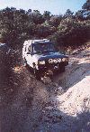
did indeed require more attention - deeper ruts, a few little rocks here
and there, some off-camber spots. Low range wouldn't hurt. Not too long
down this path, and a shock retaining nut ran loose on another well-equipped
Disco, with all accompanying hardware - washers, bushings, etc. Running
a coil-sprung vehicle without any suspenion travel limiter may result in
bigger headache, so we stopped and hiked back to hunt down that nut. Most
or even all hardware was found, for we haven't moved far away since it
happened (you'll know that you lost a shock in no time there). A few minutes'
wrestiling with a Hi-Lift and wrenches, and that Fox was back in place
tied for good.
At
some point on the trail, the forest began to change - pine and fir trees
that were the ultimate flora before were joined by small Joshua trees.
Soon, Joshua trees became dominating, and t hen - nearly the only trees
around. We came to a part of San Bernardino National Forest that is the
closest to Joshua Tree Nat'l Park. Cacti started appearing everywhere.
In a few places, some eroded mud mounds appeared (see a pic at right).
Later down the trail, we caught a glimpse on a real "golden Autumn,"
not a frequent sight in Southern California.
We returned back to 2N02, and shortly after took another trail, marked
2N16, and decorated with a black diamond by the Forest Service, meaning
it's the most difficult terrain one may encoutner.
All
in all, them Forest Service people do four-wheelers a good service, for
those black diamonds seem to scare off the mall-crawling SUV crowd. My
belief is that the trails that are really challenging - that is, lockers
mandatory, body damage guaranteed, winch is a welcome addition in a group,
and so on - these trails are not numbered and marked at all. Except for
John Bull (3N10), probably - it has a number, and is shown on most maps,
but the trailhead is not marked at all; and it can be done in an unlocked
rig.
So
was the 2N16, at some point turning 2N61 - yes, there were a few spots
where driving a Ford Explorer would result in some incurable wheel alignment
problems. A few rocky places (none near the Rock Garden on 3N93), a few
washed-out deeply-rutted off-camber spots. I've managed to decorate my
Disco with a scratch on rear quarter behind the wheel - write this off
as a driver's error (got to trust my son Yuri as a spotter - he has probably
more co-pilot off-road experience than some drivers in the group).
Some
creek crossings which may turn challenging after a decent rainstorm or
with snow run-off. The trail descends down to about 6500ft., and then climbs
back to nearly 8000 ft. In process, the trail winds up to the north-facing
slopes of the ridge south of Big Bear lake, and in many places the ground
was covered by patchy snow from the early first winter storm a few days
back.
The
trail empties into Hwy.38 only five minutes from Big Bear City.
At
the gas station, we parted ways with the gang - they returned back to camp,
and we headed home.
Must
have been a tough camping night - by the time we ate our fare at IHOP,
outside thermometer fell from 43F to 34F, and didn't indicate any slowing
down. Check the LRCSD newsletter for more details,
Happy wheelin'


